Flat Rock Hill Conservation Area
The Town of Dunstable purchased the Flat Rock Hill Conservation area in 2007 with state grant and CPA funds. The property, located in north central Dunstable, is just west of Salmon Brook. It includes the summit, and south and east slopes of Flat Rock Hill, the fourth highest hill in Dunstable (elevation 347 feet). There is extensive upland forest of mixed pine and hardwoods.
The property lies within the Petapawag ACEC and is designated “Critical Natural Landscape” in the 2010 Natural Heritage Program Biomap2. The parcel directly connects five protected areas held by the Dunstable Conservation Commission and Dunstable Rural Land Trust, totaling over 275 acres. It also abuts the old “Red Line” railroad bed of which the Conservation Commission owns the northernmost 1000 feet.
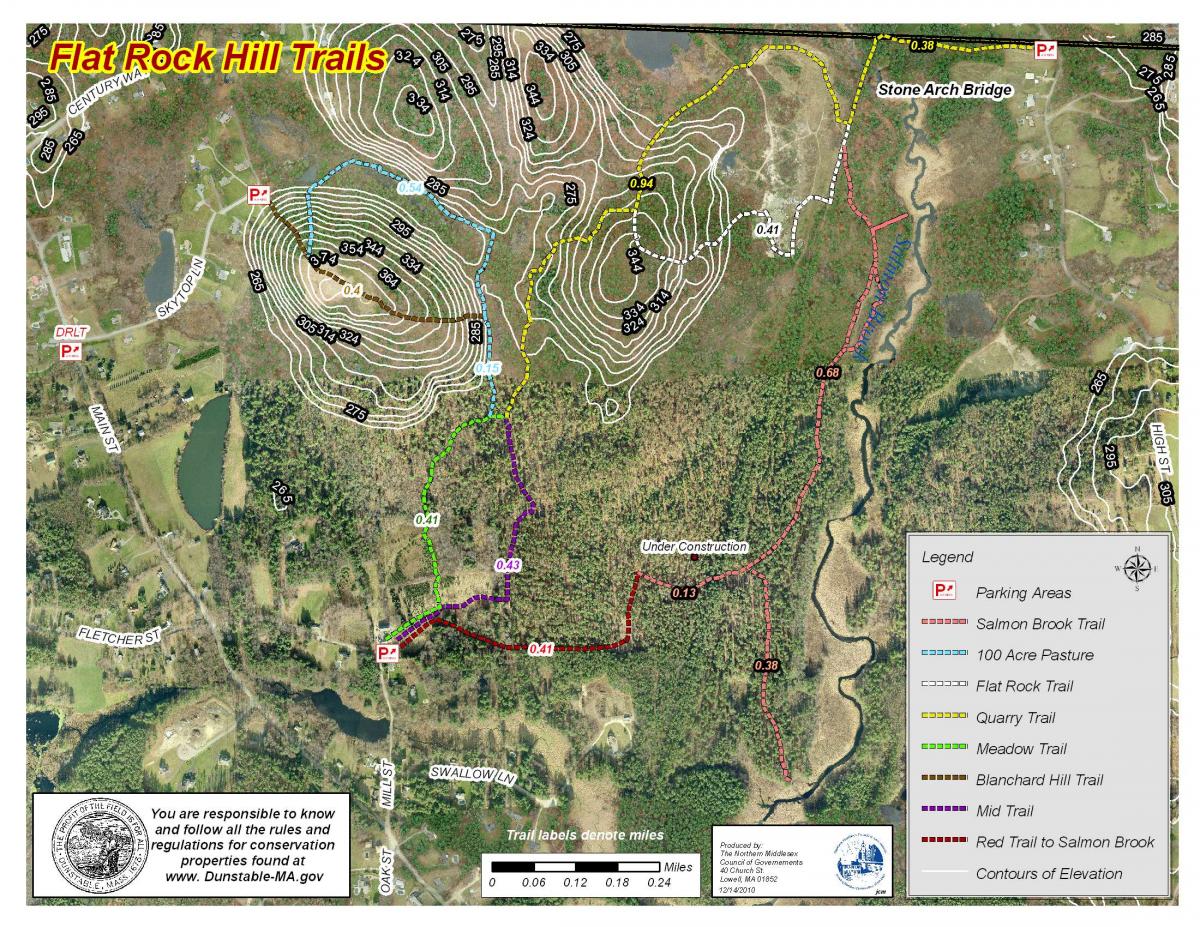
There are Red, Salmon Brook, Mid, Quarry, Flat Rock and Meadow trails and a kiosk at the entrance.